Sunday, 12 June 2011

MAARIKANIVE-CHITRADURGA JUNE 2011

VANI VILASA SAGARA DAM-(MAARIKANIVE) AND CHITRADURGA-JUNE 2011

Date : 10th, 11th and 12th June 2011
Route : Bangalore-Tumkur-Sira-Hiriyur-(150 Kms)
Hiriyur to Vanivilasa Sagara DAM(17 Kms) -
Hiriyur to Chitradurga (40 Kms)
and Back to Bangalore

The TEAM
Sateesh N (Myself)
Ananth Kaskar
Promod Solomon
Lokesh
Kumara Swamy J
Harsha AS
L-R : Promod,Kumar,Lokesh,Harsha and Ananth
TOUR REPORT

The team of Karnataka Government Secretariat Cricketers after finishing their League Matches organized by KSCA are eagerly waiting to go out to refresh their body. As we decided to plan an outing the first instance it was decided to move on to Bheemeshwari Nature Camp as it was too nearer to Bangalore, again decided to change the venue to Bhadra and Gajanur as we could not get accommodation, finally decided the destination to Vanivilasa Sagara Dam and JogiMatti at Chitradurga, Promod had a talk with this friend Nandish who is working at AC, Office, Chitradurga that we are planning to visit your place, please look into make arrangements to stay, he arranged to reserve the rooms and VaniVilasa Sagara Dam and the tour begins


10th June 2011 :


Left Bangalore at 3-30 pm from Yelahanka-Jalahalli-Nelamangala, as no one had lunch had a lunch at Petrol bunk near Nelamangala and also had petrol to the Vehicle. Reached Hiriyur by 6-00 pm, One Mr. Manjunath who was friend of Mr. Lokesh was informed to have a cup of tea at his residence in Hiriyur, after light tea and snacks we moved to Vani Vilasa Pura which is 17 kms from Hiriyur. We reached VV Pura at 7-30 pm as it was already booked Mr. Rangaswamy Incharge of the IB had given room, we had fresh’n’up and had a Dinner and went to sleep


11th June 2011:


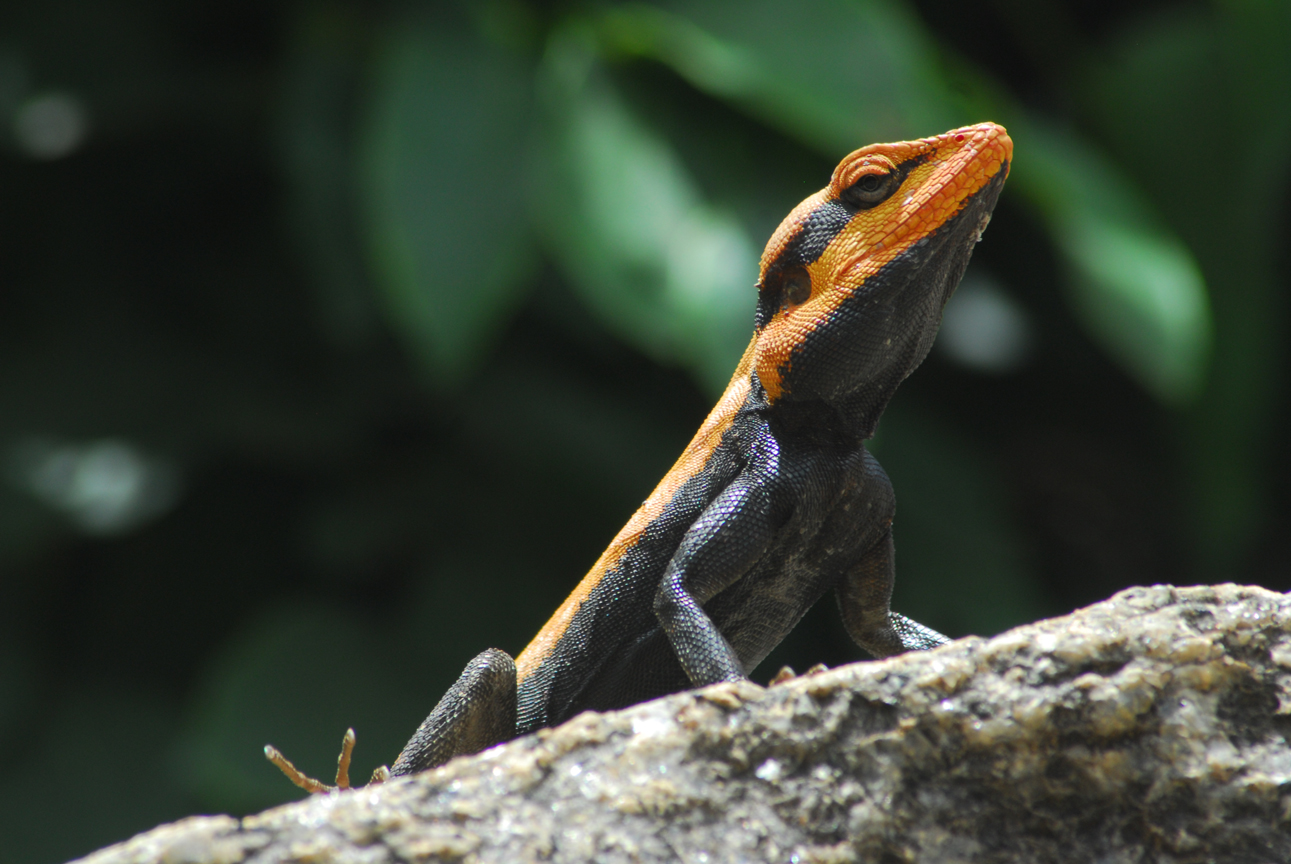
Early morning I woke up at 5-30 am as the sun was coming from the clouds, I and Ananth proceeds towards the DAM site and had a early morning view of the DAM as well as SunRise, it was one the fine views (actually I visited this place in the year 1997), I took some good pics over there and came back had bath and breakfast and decided to move to chitradurga fort, JogiMatt and in and around Chitradurga, as Mr. Lokesh had a back pain, he was stayed back in the room, we five started journey towards Chitradurga reached by 11-30 am near the Fort had Tender Coconut, after taking a Entry Ticket we moved towards the Entry, Mr Swamy the Guide approached us and informed that he would make a Fort Journey through his experience, we decided to have a guide, he took us and explained the each and one important places with his narration, he had good database of all the names who visited the place, Finally the important one we reached Onke Obavva’s Place, to narrated the full story and he took almost 15-20 mts to cover only the One Obavva’s Kindi story, as he was narrating I was clicking the pics of Chamelion nearby, finally had a small lunch over there at canteen eating Puliyogere and Alu Bajji with some tea, Majige etc, and returned back to VV Pura by 5-00 pm had tea, after finishing Tea all the team members visited the DAM Site with a spectacular Sunset view came back to Rooms had dinner went to sleep


12th June 2011:


Early morning lonely, I once again visited the DAM Site and took another round of pics. After finishing Breakfast, settling the accounts, we moved from VV Pura to Hiriyur as instructed earlier by Mr. Manjunath of Hiriyur he had arranged a beautiful Lunch at his residence (Veg and Non-Veg). From there we proceeded back towards our journey to Bangalore and reached Bangalore by 6-00 pm.


Acknowledgements:
Sri Nandish,
Sri Rangaswamy and Sri Shivanna (Cook and Caretaker at VV Pura IB)
Sri Manjuanth (Hiriyur)
And
Finally to Sri Lokesh who is the owner of Vehicle SCORPRIO
And the Drivers of our Team (Sri Promod and Sri Kumaraswamy J) who drove safely

INFORMATION ABOUT PLACES WE VISITED

Mari Kanive (Kannada: ಮಾರಿ ಕಣಿವೆ) is a dam near Hiriyur Taluk, Chitradurga District, in the Indian state of Karnataka. It is the oldest dam in the state.

The dam was built by the Mysore Maharajas pre-independence across the river Vedavathi. The dam is an exquisite piece of architecture, an engineering marvel for that time, and provides water to lots of surrounding cities, towns and villages, which are largely dry lands of the Deccan area of Central Karnataka.


History

The dam was constructed by a team led by an Engineer called 'Tara Chand Dalal' at the order of his Highness the Maharaja of Mysore Sri Krishnaraja Wodeyar IV.


 This dam is the source of domestic water for Hiriyur and Chitradurga. It irrigates more than 100 km² of land in Hiriyur and Challakere taluks through right and left bank canals. This place is 160 km from Bangalore on the NH-4 highway and 40 km from Chitradurga. For the construction of this dam royals of mysore had to pledge royal jewellery due to shortage of money,that is why it was named as "vanivilasa sagara".vanivilasa was the name of youngest daughter of the then maharaja of mysore.mari kanive is the oldest and biggest man made reservoir in asia.This dam is higher than KRS dam of Mysore.


Two Members Serious about DAM, Another Two keenly interested to give a pose


SunSet View with a colourful Clouds


Enjoying the View of Sunset at VV Sagar DAM

The dam has been a tourist attraction for many years, but has been apparently neglected as a prime tourist destination. Recently, though, the development work undertaken by the forest department to restore the nearby forest cover, and the 'panchavati' gardens-a garden of medicinal plants with the old Indian cultural theme has improved the tourist figures, making it a popular weekend picnic spot. The 'panchavati' garden has medicinal plants lined up representing cultural themes - the 'Rashis', 'Sapta swaras', 'Nava grahas' and many more. The tourists who visit Chitradurga and Hosdurga often visit Mari kanive on the way. The historic maarikaamba temple here also attracts many tourists. The place is around 20 km drive from Hiriyur on a deviation from NH4 (Bangalore - Mumbai National Highway).
(Source: Wikipedia)


Inspection Bungalow at VV Pura

CHITRADURGA

Chitradurga Fort

Built 18th century
Built by Nayakas of Chitradurga
Construction materials Granite Stones


Current condition Ruins
Open to the public Yes, Controlled by Government of Karnataka
Battles/wars Nayakas against Hyder Ali in 1760s, 1770s & 1799

Chitradurga Fort (Kannada: ಚಿತ್ರದುರ್ಗದ ಕೋಟೆ), or as the British called it Chitaldoorg, straddles several hills and a peak overlooking a flat valley in the Chitradurga District, Karnataka, India. The fort's name Chitrakaldurga, which means 'picturesque fort' in Kannada, is the namesake of the town Chitradurga and its administrative district.

The Fort was built in stages between the 10th and 18th centuries by the dynastic rulers of the region, including the Rashtrakutas, Chalukyas and Hoysalas as well as the Nayakas of Chitradurga, feudal lords in the Vijayanagar Empire. The Nayakas of Chitradurga, or Palegar Nayakas, were most responsible for the expansion of the fort between the 15th and 18th centuries. They were defeated by Hyder Ali at Chitradurga in 1779. Later the fort was expanded and strengthened by Hyder Ali and his son Tippu Sultan,who succeeded Madakari Nayaka V, the last ruler of the Nayaka clan. The fort is built in a series of seven concentric fortification walls with various passages, a citadel, masjid, warehouses for grains and oil, water reservoirs and ancient temples. There are 18 temples in the upper fort and one huge temple in the lower fort. Among these temples the oldest and most interesting is the Hidimbeshwara temple. The masjid was an addition during Hyder Ali’s rule. The fort's many interconnecting tanks were used to harvest rain water, and the fort was said to never suffer from a water shortage.


Geography


Chitradurga Fort lies in the midst of a valley formed by the Vedavati River. The Tungabhadra River flows to the northwest of the Fort. Seven hills constitute the Chinmuladri range. The seven circles of the fort enclose these hills. Features of massive rock hills and scenic valleys, huge towering boulders are seen in the fort precincts. The hills on which major part of the fort and the city rest, belong to the oldest rock of granitic formation in the country. The highest hill peak of the area is located at Jogi Matti, 5 kilometres (3.1 mi) to the south of Chitradurga. The highest elevation of the hills at the fort is 976 metres (3,202 ft).[5] The area covered by the fort is reported to be 1,500 acres (607.0 ha).

The fort is located 120 km (74.6 mi) from Hampi, the UNESCO World Heritage Site and 200 km (124.3 mi) from Bangalore. The nearest railhead is Davanagere on the Bangalore/Mysore – Arasikere broad gauge railway line.


History

Gombe Mantapa
A number of inscriptions of the Chalukyas, the Hoysalas and the Vijayanagar kings have been found in and around the fort. These inscriptions trace the history of the fort to the 3rd Millennium B.C. Ashokan period rock edicts found near Brahmagiri also link Chitradurga to the Mauryan Empire during the reign of the royal dynasties of Rashtrakutas, Chalukyas and Hoysalas. However, the area where the fort now exists achieved prominence only under the dynastic rule of the Nayakas of Chitradurga or "Paleygars" (called "little Kings") as a feudatory of the Vijayanagar Empire. 


Thaneer Konda
Between 1500 AD and 1800 AD, Chitradurga Fort witnessed a turbulent history starting with the Vijayanagar Empire; Vijayanagar Empire had got control of this region from the Hoysalas. Vijaynagar rulers brought the Nayakas, the traditional local chieftains of the area under their control as their feudatory, till their dynastic reign ended in 1565 A.D. Thereafter, the Nayakas of Chitradurga took independent control of the region and their clan ruled for more than 200 years until the last of their rulers Madakari Nayaka V was defeated by Hyder Ali of Mysore Kingdom, in 1779. During all these years, Chitradurga Fort was central to the reign, particularly of the Nayakas.


Timmana Nayaka or Thimmappa Nayaka, a chieftain from Matti in Davangere taluk, during the rule of Saluva Narasimha, was the first ruler in the hierarchy of the Nayakas of Chitradurga. Initially, he was a chieftain under the Vijayanagar Empire but was soon elevated to the rank of Governor of Chitradurga by the Vijayanagar ruler in recognition of his excellent provence in military service to the empire. His rule covered areas of the Davangere district and Chitradurga district. His rule lasted for a brief period and ended with his incarceration and death in the jail of the Vijaynagar Empire. After him, his son Obana Nayaka or Madakari Nayaka (1588–1602) succeeded him. Madakari Nayaka was followed by a series of hierarchical or other adopted forms of successions of the same clan; Madakari Nayaka V was the final ruler of the clan from 1758 to 1779. Bharamappa Nayaka who ruled from 1689 till 1722 is regarded as the greatest of the Nayaka rulers famed for building forts, palaces, tanks and temples, including several gateways and bastions. He fought several battles against the Mughals.


However, it was during the reign of Madakari Nayaka V (1758 to 1779) that the city of Chitradurga and the Fort were besieged by the troops of Hyder Ali. Madakari Nayaka used the fort effectively for defense during three battles that were fought against Hyder Ali. At times he had allied himself with Hyder Ali of Mysore Kingdom and at other times with the Marathas. Hyder Ali attacked the Chitradurga Fort first time in 1760, the second time in 1770 and the third time successfully in 1779 when he defeated Madakari Nayaka. Madakari Nayaka was taken a prisoner and killed. Nayaka's gamble of playing with both Hyder Ali and the Marathas did not work out. He was betrayed by the Marathas and some local Muhammadan officers in his service. Subsequent to his death the treasury at the fort is said to have yielded a rich bounty. It was during one such war that the heroics of Onake Obavva, the wife of a soldier guarding the fort became a legendary event.


Two men holding and Two pulling pushing the hill (Mr Hercules and Gang)
The dynastic reign of the Nayakas lasted for over 200 years and the Chitradurga fort was their stronghold and the very heart of their province.


In the Fourth Mysore War, Tippu Sultan was killed by the British in 1799, and the Mysore Kingdom was reordered under the Wodeyars. Chitradurga became a part of Mysore province. The British considered Chitradurga Fort a potentially useful base for providing a strong line of defense to Mysore's northern border. Between 1799 and 1809, the British garrisoned their troops in the fort. Later, the control of the fort was restored to the Government of Mysore.

Brave woman


Guide Narrating the history of Onake Obavva near Obavva's Kindi
Heroic deeds of a woman named Obavva, wife of a soldier called Kalanayak was guarding a fort tower, substituting for her husband during a lunch break. She was guarding the Chitradurga Fort at a crack opening, a secret opening (where only one person could barely squeeze through). Her heroics at this location have entered the annals of legendary folklore of the Karnataka State. While fetching water, she heard the muted sounds of enemy soldiers attempting to enter the fort through the crevice. With great presence of mind she immediately hid behind the crevice in the fort and hit at each soldier trying to squeeze through the crevice with Onake, the name given in Kannada to a masse or pestle, a wooden rod used for pounding paddy. In this process, she bravely killed several enemy soldiers. By the time her husband appeared on the scene, she had already dragged several bodies of dead soldiers into the fort wall and was standing around the dead bodies with the blood stained Onake in her hand. Kalanayak blew the bugle when other soldiers also joined him and killed all the enemy soldiers. This brave act saved the fort on that day from further attacks by Hyder Ali’s soldiers. Her heroic act has been commemorated with her impressive statue (sculpted by Ashok Gudigar) erected in front of the District Commissioner’s office in Chittradurga town. The stadium in the town has also been named after her. This act also earned her the epithet Onake Obavva and the crevice in the fort where she showed her bravery is called Onake Kindi. However, in the battle for the fort, Madakari Nayaka V lost and Chitradurga fort eventually fell to Hyder Ali, in 1779.


Temples in the fort


Venugopal Swamy Temple
 Entrance to Hidimbeswara Temple. Hidimba and Hidimbi are stated to have lived here
Eighteen temples were built in the upper fort. Some of the well-known temples were: the Hidimbeswara (an ancient legend is linked to it), Sampige Siddeshwara, Ekanathamma, Phalguneshwara, Gopala Krishna, Lord Hanuman, Subbaraya and Nandi
Hidimbeswara temple displays the tooth of Hidimba, the giant (Rakshasa in Sanskrit). It is said that Hidimba and his sister Hidimbi, a giantess, used to live in this temple. Hidimbi, who fell in love with Bhima (the second of the Pandava brothers of Mahabharata) married him and had a child by him named Ghatotkacha. A large cylinder about 3 metres (9.8 ft) in circumference and 2 metres (6.6 ft) high made of iron plates known as Bheri or Drum of Bheema is also located here. A monolithic pillar and two swing frames are also seen at the gate to this temple. Sampige Siddheshvara temple can be seen at the foot of the hill. In the Gopalakrishna Temple, inscriptions date the idol to the early 14th century.

In the lower fort, a temple dedicated to the tutelary deity of the Nayaka Palegars, the Uchchangiamma or Uthsavamba, was built, amidst the rocks of the fort complex on the hill
The Murugarajendra Matha, a famous religious institution of the Lingayats, which was originally located within the fort, is now situated about 2 kilometres (1.2 mi) to the northwest of Chitradurga]

Other structures
One of the tanks in cascade development in the precincts of the fort.Rain water-harvesting structures were built in a cascade development, which ensured large storage of water in interconnected reservoirs. It is said that the fort precincts never faced any water shortage.

Historical linkage has been established by an archeological inscription dated 1284 AD found in the Panchalinga (Five Lingas) cave in the Ankhi Matha area, to the west of Chitradurga. The inscription attributes the establishment of the Five Lingas, (aniconic symbols of Lord Shiva), to the Pandavas. At Ankhi Matha, approached by stone steps, a series of ancient subterranean chambers cut out at different levels are seen, in addition to several places of worship and platforms
In the lower fort, a Cutcherry (Administrative office) was added during Tippu Sultan’s rule. Another interesting find in the arsenal is a quadruple mill made of masonry of 3 metres (9.8 ft) depth and about 7 metres (23 ft) dia, which is inferred as a device used for preparing gun powder during Hyder Ali and Tippu Sultan’s rule. In Kannada language, it is called 'Maddu Bisuva Kallu', which means "Gun Powder Grinding stone". The quadruple mill has four massive grinders with teeth or slots. These were rotated either by elephants or bullocks (in a central circular space) with independent collection point for each of the four slots to collect the explosive gun powder.

Palegarara Kacheri (Office of the erstwhile Palegars)


Inside view of Palegaar's Kacheri

I found this  Macaque, (Monkey) near the Fort (Just besides Onake Obbava's Kindi, it was trying to get the Empty Slice Drink Tetra Pack from the Dust Bin. and he did not know to drink, he was trying i clicked all the below fotos


Thursday, 2 June 2011

BANDIPUR WILDLIFE TOUR - (MAY-JUNE 2011)

I had been to Bandipur with fellow photographer friends
Sri H Satish, 
Sri. S Viswanath, and
Sri Harish
on May 31st, June 1st and June 2nd 2011


30th May 2011


We started our journey at 3-45 pm from Bangalore towards Bandipur, enroute we reached Mysore had a beautiful dosa at Mylari Hotel in Mysore and reached Gundlupet and we stayed at PWD IB at 09-30 pm  had Dinner,went to sleep.


31st May 2011


Morning at 5-00 am we moved from Gundlupet to Bandipur, now the route has been closed during 9-00 pm to morning 6-00 am, when we reached the Melkamanahalli (Bandipur Entry Gate) a lot of vehicles were in the queue exactly at 6-00 am the gate opened and we reached Bandipur by 7-00 am (first trip) as we reached Bandipur we booked for Safari and went the Driver Sebastian Vehicle we were lucky to spot Indian Guar, Crested Serpent Eagle, Peacock, Langur’s, Deer, Spotted Deer’s, Wild Boar, Varieties of Birds and many more


And after coming from first trip we again went next trip with the same vehicle nothing much it repeated as said earlier, after having beautiful breakfast Upma and Shavige Bhat we roamed in and around Bandipur Reception Centre had a some beautiful extravaganza games by monkeys in and around Cottages, we took some snaps as they playing etc


We decided to go exclusively in the private vehicle as we approached and requested DFO Office, Manager said I cannot arrange private vehicles inside the forest, I will get you a vehicle and arranged a Office Tata Sumo Vehicle. We had lunch and had took a small nap and fresh’n’up we reached the Reception Counter, Our Vehicle Tata Sumo with Driver Cheluvaraju was waiting, we entered the forest safari as soon as we entered we found Elephant with calf’s after taking some snaps we had moved towards shooting spot Driver Cheluvaraj Spotted a Leopard Saying "Chirathe Sir Chirathe” it was attacking something as soon as we stopped our vehicle we took some good snaps within a few minutes it went inside the bushes we followed to trace where the Leopard went and waited nearly 10-20 mts it was inside the bush r else it was moved to another place and finally we came back same route where the Elephant with Calf still there and had a nice view of Indian Guars rest again same peacock, mongoose etc, we came back to our Cottage had Dinner and Slept with We decided to go 2 continuous trips to the sanctuary next morning with the same vehicle.


Early morning we approached DFO, he informed that he cannot arrange the separate vehicle or private vehicle to enter Forest and asked us to take Gypsy which cost Rs. 3500 per trip and requested to get one trip with the same vehicle (TATA SUMO) in the evening by 3-00 pm and he instructed the Official there to arrange the evening safari with the TATA SUMO vehicle for us.


Again we had decided to have continuous trips in the VAN for safari with the same Mr. Sebastian Vehicle nothing spotted except the same mongoose, deer’s and peacocks and came back from Safari after having breakfast we decided to move towards Gopala Swamy Betta, We reached GS Betta by 11-00 am had darshan of Sri Venugopala Swamy and met priest over there who was a good friend of us, he performed special pooja for us and had a prasadam over there we had captured some good landscapes from there we came back and had Lunch. At 3-15 pm we reached the Reception Counter waiting for the Vehicle, as that Vehicle was not there as it was been directed  to deliver ration to the Anti Poaching  Camps, we waited upto 5-00 pm no sign of vehicle, dejected over, and after having tea at local tea shop, went towards  Border of Karnataka-Tamilnadu (Kakkanahalla) on the Ooty road from Bandipur. We saw a herd of Elephant with calf on the road side and a big herd of Indian Gaurs (nearly 30-40) soon lightning and a drizzle of Rain started, we took some good snaps of Elephant Crossing the Road.

Still to Come................................


THE INFORMATION ABOUT BANDIPUR
Bandipur Tiger Reserve


Introduction


Bandipur Tiger Reserve situated in Mysore District of Karnataka State of India was among the first nine Tiger Reserves created in India at the launch of Project Tiger in 1973. It is contiguous to Madhumalai Wildlife Sanctuary in Tamil Nadu state to south and Wynad Wildlife Sanctuary in Kerala state to the south-west.To the north-west lies Nagarhole National Park. The highest peak is Gopalaswamy hill.


The main perennial rivers of the Reserve are Nugu, Kabini and Moyar. The Nugu river flows in the middle of the Reserve. Whereas, the Moyar river forms the southern boundary between this reserve and Madhumalai Wildlife Sanctuary. The Kabini river, across which a major irrigation dam has come up at Beechanahalli, forms the boundary between this Reserve and Nagarhole


National Park of Karnataka. The Kabini reservoir provides water facility and the grazing ground on the foreshore, for hundreds of elephants during severe and prolonged pinch period. Seasonal streams like Wadli, Chammanahalla, Aidasanahattihalla, Hebballa, Warranchi, Chippanahalla and Mavinahalla are also present.


INDIAN GAUR
LANGOOR AT BANDIPUR, GETTING READY TO DRIVE  HIS VEHICLE
 
LEOPARD AT BANDIPUR

LEOPARD AT BANDIPUR


History :
A Sanctuary of 90 sq. km. area was created in Bandipur Reserve Forest in 1931. Venugopala Wildlife Park &was constituted in 1941, extending over 800 sq. km. The Park was named after the god, Venugopala of the shrine atop Gopalsawamy Betta. Bandipur Tiger reserve was formed by including most of the forest area of the then Venugopala Wildlife Park and its sanctum sanctorum at Bandipur, in the year 1973 and named Bandipur National Park


Bandipur lies in the southern state of Karnataka and covers a forest area of 865 square kilometers. It was declared a National Park in 1974 and is one of the original 9 tiger reserves under the watchful eye of "Project Tiger".


Crested Serpent Eagle
Bandipur National Park begins to blossom with all its beauty due to the arrival of pre-monsoon showers in April. The grasslands with developing grass are dominated by elephants and the majestic gaur. Bandipur is a paradise between Aprils to October, for the tourist coming to watch the larger mammals in their natural habitats. During the summer season, when dryness exists over most parts of Bandipur, the backwaters of the Kabini Reservoir in the northwestern part of the park entertains huge gathering of large mammals, especially the elephant and the gaur. This rare character of Bandipur National Park makes a breathtaking view, and is almost the only one of its kind in Asia .


Forest Types
MONGOOSE
Dry deciduous scrub, Southern tropical/Dry deciduous & Southern Tropical Moist Mixed deciduous forests cover the reserve area.  


Major Flora


Main Species
Tectona grandis, Dalbergia latifolia, Pterocarpus marsupium, Adina cordifolia, Grewia tiliaefolia, Amblica officianalis, lagerstroemia lanceolata, Terminalia tomentosa, Anogeisus latifolia, Terminalia chebula, Schleichera trijuga, Odina wodiar, Butea monosperma, Cassia fistula, Dendrcalamus strictus, Bambusa arundinacea,Chloroxylon swetenia, Acacia catechu, Shorea talura, Randia uliginosa


Tiger, Leopard, Elephant, Gaur, Sambar, Spotted deer, Sloth bear, Mouse deer, Wild dog, four horned Antelope can be spotted in Bandipur National Park .


ELEPHANT WITH YOUNG ONE
Elephant Crossing Road


Birds
Common Vabbler, Wood Pecker, Warbler, Weaverbird, Kingfisher, Drongo, Fly catche, Hornbill etc.


Endangered Species
Tiger, Four horned Antelope, Gaur, Elephant, Panther, Sloth bear, Crocodiles, Mouse deer, Python, Osprey, Pea fowl.
Spotted Deer
Safari In Bandipur


Over about 1000 elephant's roam through the park and it also harbors a wide variety of other animals, reptiles and birds.


Bandipur Van safari Timings
Morning 6:30 AM to 9:00 AM.
Evening 3:30 PM to 6:00 PM.


Bandipur Jeep Safari Timings
Morning
First Trip: 6:30 AM to 9:00 AM.
Second Trip: 8:00 AM to 9:30 AM.
Evening
First Trip: 3:30 PM to 5:00 PM.
Second Trip: 5:00 PM to 6:30 PM.
VAN
[Rs.300 per head for 45 Mts round trip in a 25 seater van.]
(Rs. 200 Park Entry Fee and Rs. 100 for Safari)

GYPSY
Rs.3500 per Jeep (maximum six people allowed).

[Depends on the Visitors]


Accommodation

Forest Dept Guest House
[to be booked from Aranya Bhavan, Mysore -(0821-2480902)


Hotels / Resorts in Bandipur:
Accommodation can be arranged at forest rest house, resorts, guesthouses at Hangala, Mangala


Vali-Sugreeva

Here are some of the list of premium, luxury, budget hotels and resorts for your comfort accommodation in Mudumalai.
Angada Waiting
Premium / Five Star Resorts 

Luxury / Budget Accommodation


Jungle Home Guest House, Mudumalai
Forest Guest House, Bandipur
Tiger Ranch, Mangala
Country Club, Bush Betta, Mangala
Nilgiris Resort, Hangala
MC Resorts, Hangala
Dhole's Den, Hangala


Tourism Places


The places of tourist attractions are

Gopalswamy betta (Hill) temple is located at 21kms from Bandipur National Park . A god by name Venugopala shrine atop this hill.


A PANORAMA VIEW OF GOPALASWAMY BETTA

VIEW FROM GOPALASWAMY BETTA


Venugopala Swamy Temple, Himvad Gopalswamy Betta
 

WILD FLOWER AT GS BETTA
 

HIMVAD GOPALASWAMY BETTA TEMPLE WITH FOG

FOREST VIEW FROM GS BETTA

Aerial View of Bandipur Forest from Gopala Swamy Betta


Mudumalai (Tamil Nadu)


Mudumalai Wildlife Sanctuary is a combined Sanctuary with Bandipur National Park which is located at 12km on south side of Bandipur. Mudumalai wildlife sanctuary was the first sanctuary in south India . The land is extremely varied with hills, valleys, narrow valleys, waterways and swamps. It includes of tropical moist deciduous forests, dry deciduous forests and scrub forests

Monday, 21 March 2011

World Sparrow Day -20th March

World Sparrow Day


The World Sparrow Day (WSD) is being celebrated on 20th March across the globe to raise public awareness about the decline of the house sparrow and throw light on the problems faced by the species in its daily fight for survival.

The World Sparrow Day also celebrates the common biodiversity around us.


The first World Sparrow Day was celebrated on March 20, 2010 across the globe to celebrate the beauty of the house sparrow. National and international organisations, NGOs, clubs and societies, universities, schools and individuals across the world celebrated the event by organizing awareness programs.

The House Sparrow (Passer domesticus) is a species of passerine bird of the sparrow family Passeridae. It occurs naturally in most of Europe, the Mediterranean region, and much of Asia. It has also been intentionally or accidentally introduced to many parts of the world, making it the most widely distributed wild bird. It is strongly associated with human habitations, but it is not the only sparrow species found near houses. It is a small bird, with feathers mostly different shades of brown and grey.


I took this Sparrow Pics when i toured Kaiwara, near Kolar

  
Various causes for the dramatic decreases in population have been proposed, including predation, electromagnetic radiation from mobile phones, and diseases. A shortage of nesting sites is probably a factor, and conservation organisations have encouraged the use of special nest boxes for sparrows. The main cause of the decline seems to be nestling starvation due to an insufficient supply of insect food. The decline in the insect population is caused by an increase of monoculture crops, the heavy use of pesticides, the replacement of native plants in cities with introduced plants and parking areas, and possibly the introduction of unleaded petroleum, which produces toxic compounds such as methyl nitrite. Protecting insect habitats on farms, and planting native plants in cities benefit the House Sparrow, as does establishing urban green spaces
Kingdom: Animalia
Phylum: Chordata
Class: Aves
Order: Passeriformes
Family: Passeridae
Genus: Passer
Species: P. domesticus


Sunday, 20 March 2011

Super Moon-19th March 2011

In astrology, a supermoon is a full or new moon that coincides with a close approach by the Moon to the Earth. The Moon's distance varies each month between approximately 354,000 km (220,000 mi) and 410,000 km (254,000 mi) due to its elliptical orbit around Earth

The largest full moon in more than 18 years - a so called SUPERMOON did not disappoint eager skywatchers around the world SATURDAY the 19th March 2011 when in rose, big and bright, into Earth's nigth sky

The full moon of March was 221,565 miles (356,575 kilometers) on Saturday, March 19 just 50 minutes after it hit its full phase, making it the biggest and brightest full moon since 1993. The "supermoon" phenomenon occurred because the moon was in its full phase and just 50 minutes past perigee – the point of its orbit that brings it closer to Earth.

This year's biggest full moon also gained notoriety after erroneous claims that it would spark waves of natural disasters around the world

[I took the Supermoon Photos from my Residence Terrace]


Dates of supermoons between 1950 and 2050


A supermoon image of March 19, 2011There are approximately four to six supermoons annually.[3] The following is a list of past and predicted extreme supermoons.[14][15]

November 10, 1954
November 20, 1972
January 8, 1974
February 26, 1975
December 2, 1990
January 19, 1992
March 8, 1993
January 10, 2005
December 12, 2008
January 30, 2010
March 19, 2011[16]
November 14, 2016
January 2, 2018
January 21, 2023
November 25, 2034
January 13, 2036

and one of the Spider which was weaved a WEB in one night, it was attached to my vehicle near the window of my residence,  i shoot this pic

Friday, 11 March 2011

Tsunami Hits Japan

Tsunami Hits Japan, At Least 300 Dead, Warnings Issued for Hawaii
Japan was hit with a major tsunami on Friday, bringing 13-foot waves following an 8.9 magnitude earthquake off the coast.

A earthquake hit northern coast of Honshu, Japan on March 9, 2011. The Japan earthquake registered 7.2 on the Richter Scale; a 6.3 magnitude aftershock was felt shortly after.


A tsunami warning has been issued for Japan's northeastern coast. There have been no early reports of damage or injuries due to the Japan earthquake.

A local meteorological agency warned that a tsunami of about 20 inches would hit the areas of Iwate, Miyaga, Fukushima around noon Wednesday.

Japanese officials are reporting at least 300 people are dead and many others are missing, but those numbers are expected to increase as they assess the damage.

The tsunami washed away buildings, homes and cars and caused extensive damage.

The earthquake hit at 2:46 p.m. bringing with it strong aftershocks.
The earthquake is the largest in Japan’s history.

Prime Minister Naoto Kan was on TV, telling residents to remain calm in the midst of the devastation.

“The earthquake has caused major damage in broad areas in northern Japan,” Kan said, and urged people to move to higher ground.

Experts are warning more giant waves could hit land, not only in Japan, but in Hawaii, South America, Alaska, the U.S. West Coast and British Columbia.

The governor of Hawaii ordered the evacuation of coastal areas and warned residents to take the threat seriously.

The first waves to hit Hawaii could reach 6 feet high and were expected to hit about 3 a.m. local time (9 a.m. EST.)

Waves are predicted to hit the western coast of the United States between 11 a.m. and 11:30 a.m. EST Friday. People near the beach and in low-lying coastal areas of Point Conception in Santa Barbara County were told to move immediately inland to higher ground.

While the tsunami is likely to go around smaller islands, the size of Hawaii’s islands will amplify the waves, which will crash hardest against harbors and inlets.
--------------------------------------------------------------------------------------
Earthquakes are more dangerous (source : washington.edu)


Closer to the focus Communities that are closer to the focus of an earthquake usually experience stronger shaking.

Nearer to the surface Earthquakes that occur near the surface cause more damage than those deep underground.

As the shaking goes on The longer the shaking continues, the more damage it causes. The 2001 Nisqually earthquake lasted about 40 seconds. The 1700 subduction zone earthquake may have lasted five minutes.

On loose ground Loose materials—landfills and loose sediments—shake more than solid bedrock. Geologists compare this to a bowl of jelly. If it’s jostled, the bowl itself will shake just a little. But the jelly keeps on jiggling; it actually amplifies the motion.

On wet soil If loose soil is saturated with water, it may flow like a liquid when shaken in an earthquake. This process is called liquefaction. The soil loses its strength and no longer supports structures built upon it.

On slopes During quakes, slopes may slide. Also, if trees have been cut down, slopes are more vulnerable to earthquake damage. Slopes composed of loose backfilled materials may be unstable during quakes.

Near structures If you’re in the middle of a wheat field, you’re not likely to be hurt by an earthquake. Most damage—and most injuries—involve human structures. Unreinforced brick walls and chimneys can’t handle the side-to-side shaking of a large earthquake. Falling bricks are a major cause of injuries. Older concrete structures also may be unstable. And even a small earthquake may bring household objects down around your ears. Damage to lifelines—roads or bridges—can have life-changing impacts on area residents. Whole communities may be cut off from fire engines, ambulances, and supplies.

Research for safety

Although we can’t prevent earthquakes, engineering researchers are pioneering safer construction techniques to protect us from earthquake damage. Homes now are bolted to their foundations, brick and concrete are specially reinforced, and roads, bridges, and buildings are built with earthquakes in mind.